Jeff Galang
Portfolio
GIS Web API City of Richmond
This web API utilizes ArcGIS Server, ASP.NET MVC, ASP.NET Web API, Entity Framework, Ninject, Bootstrap, and more to provide enterprise-wide GIS data integration with other IT divisions. It is a collection of smaller RESTful API modules that expose GIS data, including real-time metadata, map generation, geocoding, and access to geodatabase items.
Each module within the API provides domain-specific functionality and includes documentation extracted from the C# code, live samples, and sample syntax.
The following are individual components of the GIS Web API:
Auto-complete Geocoding
The geodata module provides access to specific geodatabase information such as addresses. The module is self-documenting by extracting XML code comments from the API controller's documentation.
Sample
Static Map Generator
This web utility demonstrates the use of the Map Images module by allowing a user to specify parameters to submit to an AJAX request in a user friendly interface.
Sample image
Metadata Retrieval
The metadata module demonstrates real-time retrieval of geodatabase metadata.
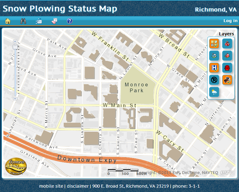
Snow Plowing Status Map City of Richmond
This is a public web application built using ASP.NET MVC and the ESRI JavaScript API to provide the public with a map of snow plowing status during winter events. City employees edit snow routes using the application to indicate progress during an event (unfortunately, this editing is restricted to city employees). It uses an ArcGIS Server Feature Service to perform the editing.
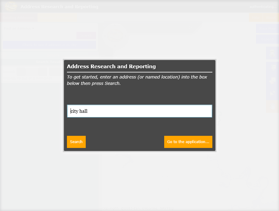
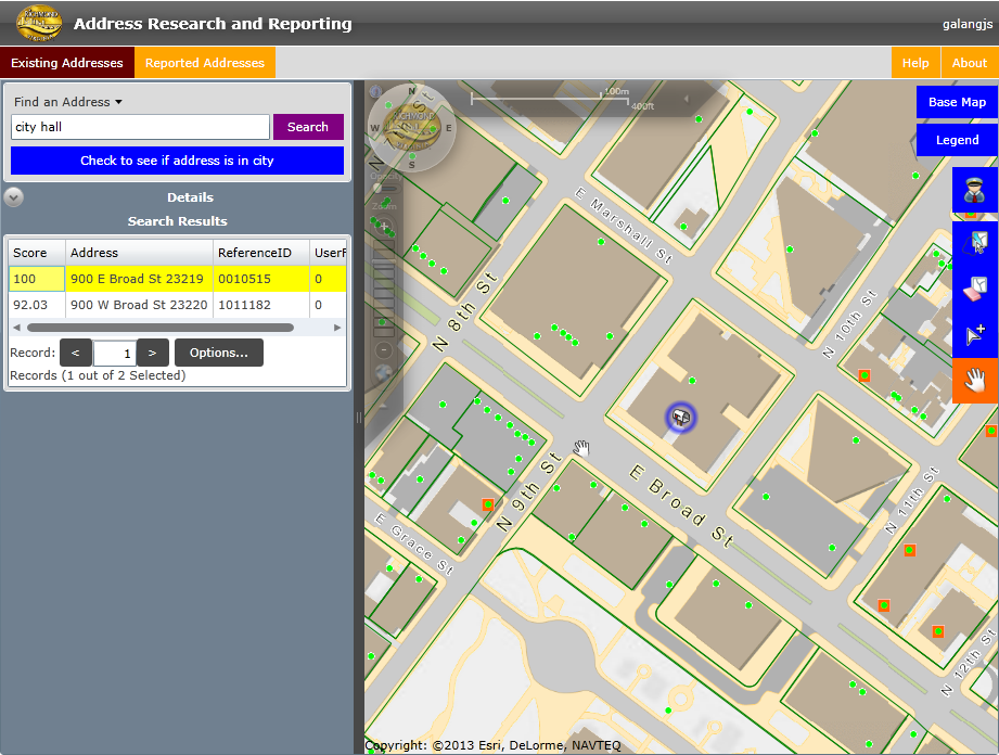
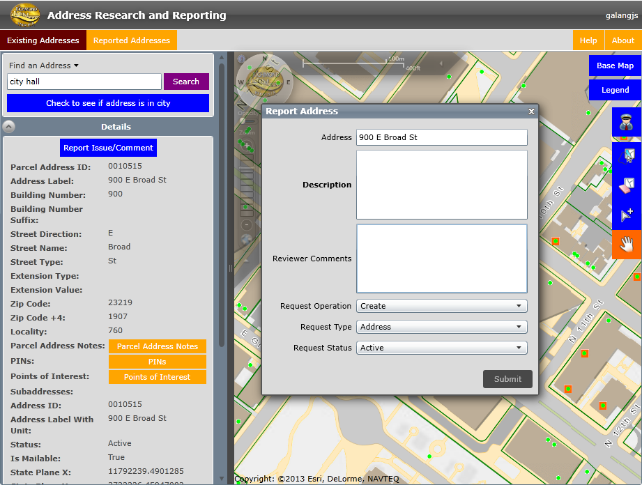
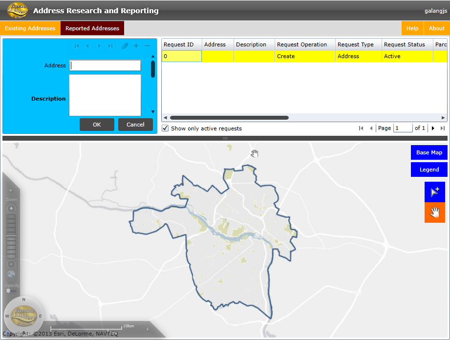
Address Research and Reporting City of Richmond
This internal Silverlight application is based on the City of Richmond's GIS Web API and is designed to give city staff the ability to research questionable addresses and report any issues with them. The application uses an internal token-based security system to authenticate the submission of issues throught the REST API.
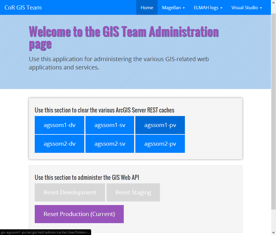
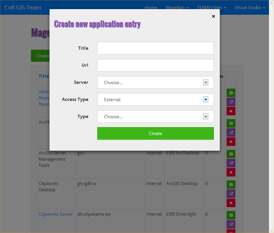
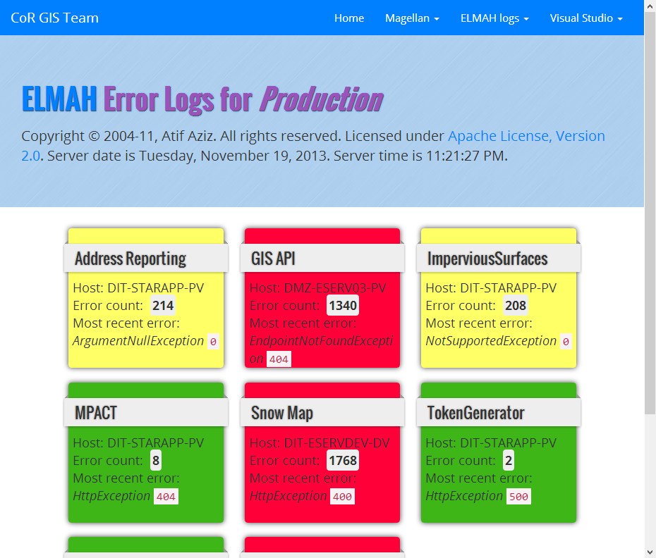
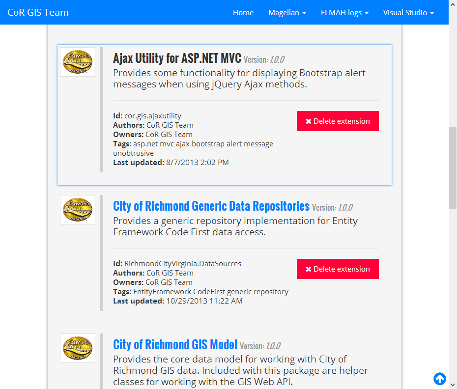
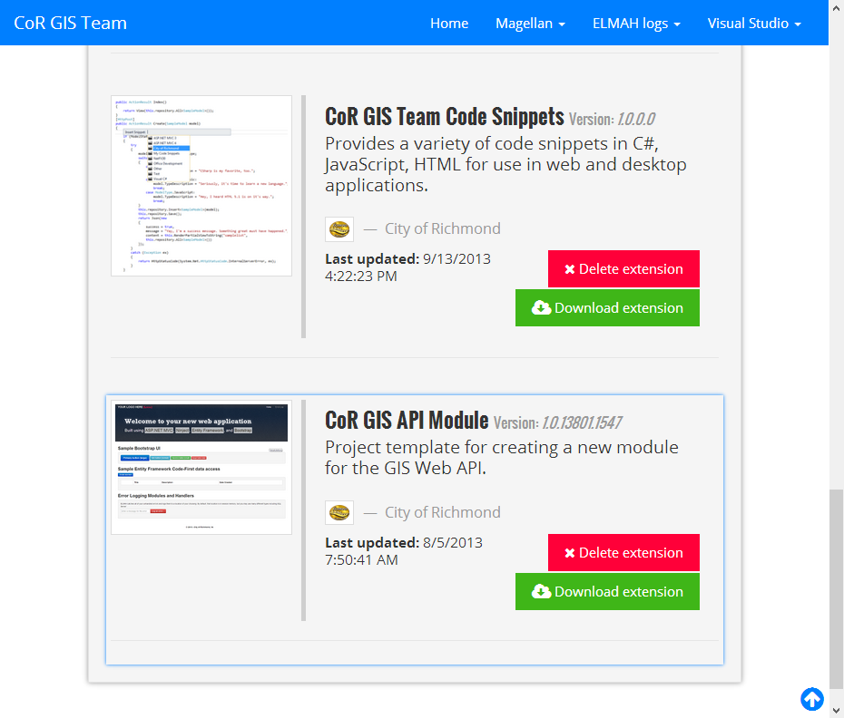
GIS Team Administration City of Richmond
This is an internal web application built using ASP.NET MVC, Entity Framework, and Bootstrap to allow the city's enterprise GIS team to manage various aspects of their web-based applications. Some examples of functionality include maintaining an inventory of applications and related web services, viewing error logs, ArcGIS Server administration, and hosting of a Visual Studio extension gallery as well as a Nuget feed.
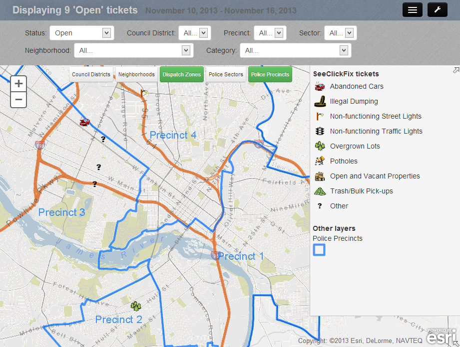
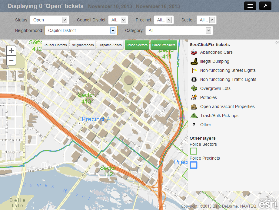
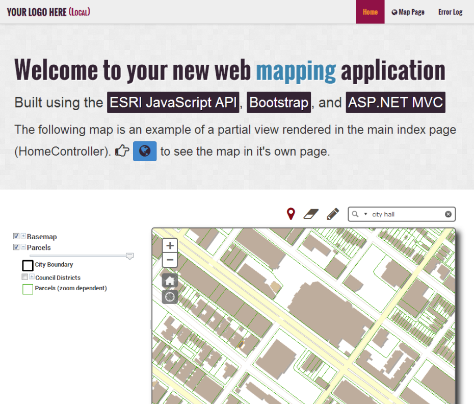
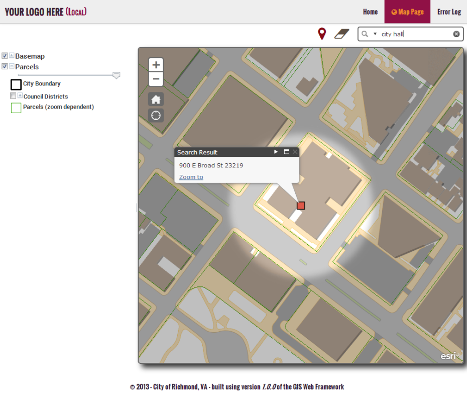
MPACT Web Mapping Application City of Richmond
Git Source JavaScript CSS HTML
This is an internal web application built using ASP.NET MVC, Entity Framework, ESRI JavaScript API, and Knockout.js that displays SeeClickFix reported issues for a given time period. It's purpose is to give city officials a reporting tool for the city's MPACT project.
JavaScript
The main JavaScript file used in the application is shown below. It contains elements from ESRI's JavaScript API as well as bits of Knockout and jQuery.
CSS/LESS
I prefer to use LESS to compile my stylesheets. Here is the LESS file for the MPACT application.
HTML
Most of my web applications are built using ASP.NET MVC on the back-end. I generally prefer the Razor syntax.
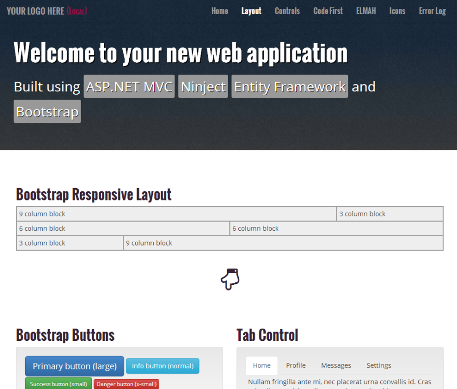
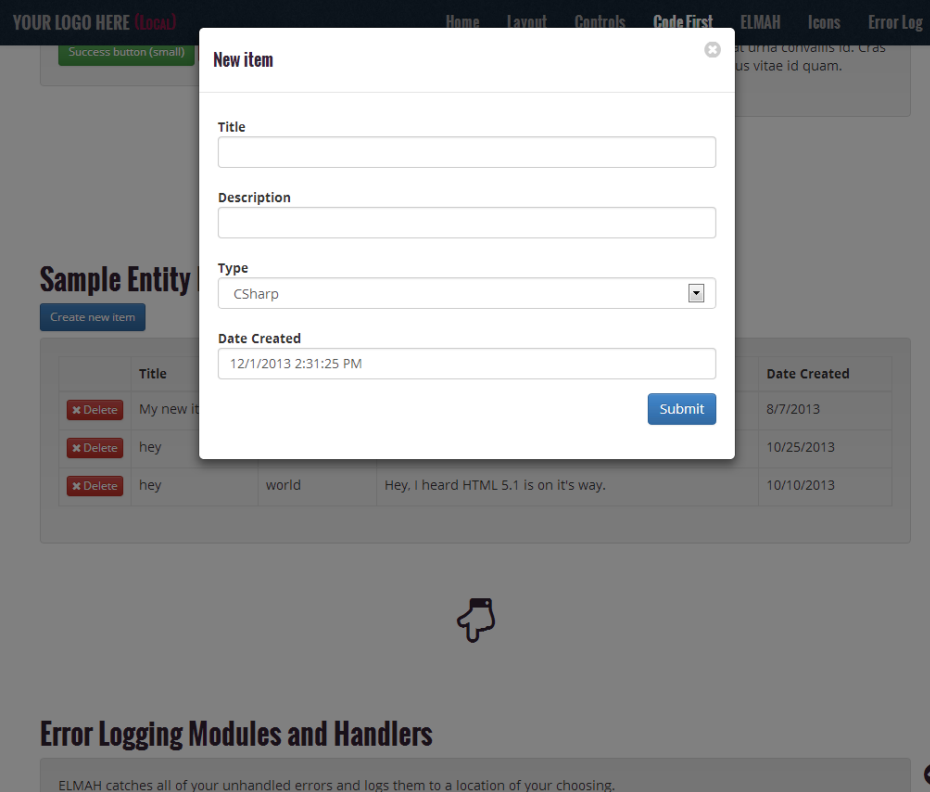
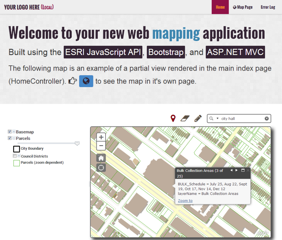
Visual Studio Web Application Templates City of Richmond
Git Source JavaScript CSS HTML
These web application templates are for use within Visual Studio 2010+ and are designed for rapid application development by City of Richmond application developers. They are built using ASP.NET MVC, Bootstrap, Entity Framework, ELMAH, Ninject, ESRI JavaScript API, and a variety of JavaScript plugins.
JavaScript
The main JavaScript files used in the templates are shown below. The first is for the map template and the second for the basic template.
CSS/LESS
I prefer to use LESS to compile my stylesheets. Here are the LESS files for the templates.
HTML
Most of my web applications are built using ASP.NET MVC on the back-end. I generally prefer the Razor syntax.
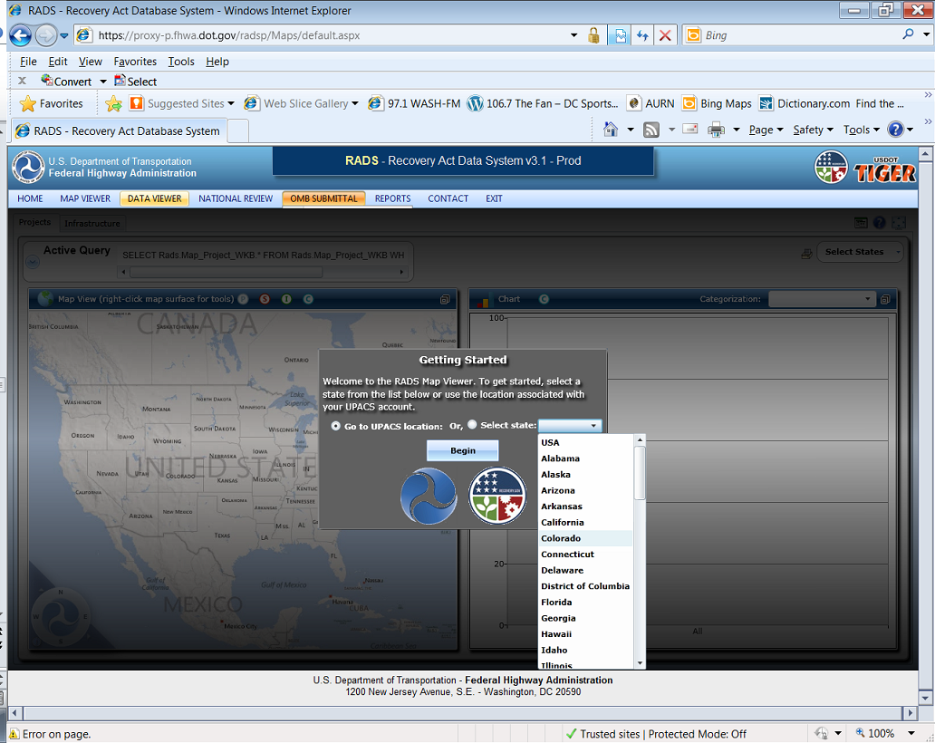
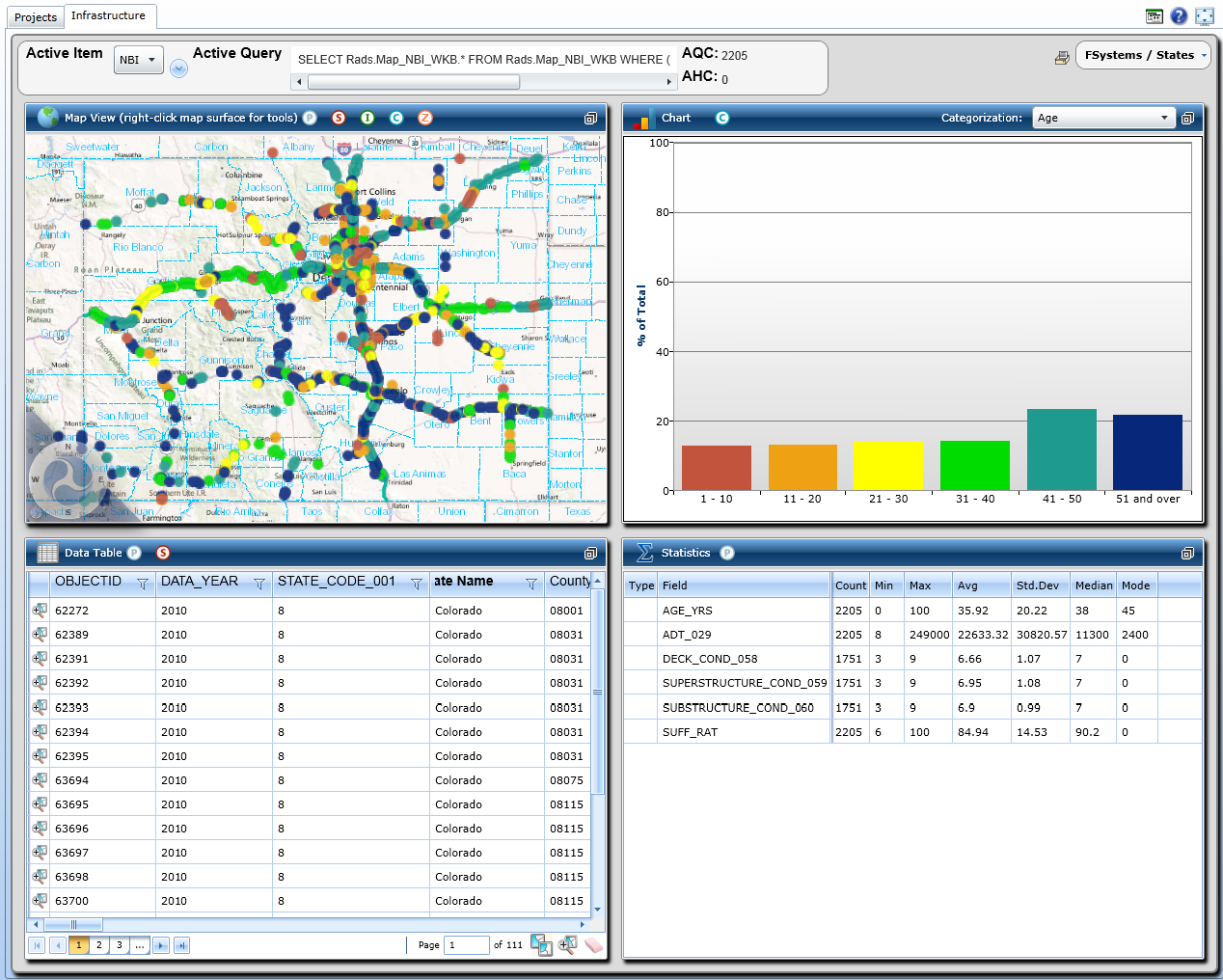
Recovery Act Data System Federal Highways Administration
I assisted with this application by providing some Silverlight tooling such as the navigation controls and basemap selectors. Another Silverlight application that I was involved with was an updated version of the above link that was internal to the FHWA. Screenshots of this application are below.
Bootstrap Themes Personal
JavaScript CSS HTML
I build themes built using Bootstrap 3 that are intended to be sold online. Because this is a commercial product I have decided to not make the source available. However, the major parts of the application can be found below and you can always view source on the theme itself (although the JavaScript and CSS are minified).
JavaScript
The main JavaScript file used in the theme is shown below.
CSS/LESS
I prefer to use LESS to compile my stylesheets. Here are the LESS files for the templates.
HTML
Because the theme is composed on several different views, the entire rendered output is displayed in this gist.
Silverlight Table of Contents Control Personal
This is a control for use with ESRI's Silverlight API that I created pre-ArcGIS Server 10 when they introduced legends in the REST API. While it's debatable as to whether a map should even have a TOC a fair number of people found this to be useful.